


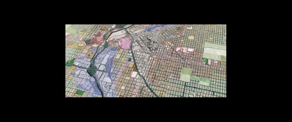
A Berkeley professor brings urban development to life.
Could visualizing the effects of local development proposals in a 3D simulation encourage citizens to become more engaged in determining how their cities and neighborhoods will grow? Denver, Albuquerque, and Salt Lake City are three cities that are betting that it will.
Each has recently contacted Berkeley professor of urban and regional planning Paul Waddell with the hope that the latest iteration of his nearly two decades of planning research will help engage the cities’ constituents in complex policy decisions in 2013. Waddell has led the creation of UrbanVision, a dynamic open source software system that replicates an existing urban area virtually, allowing the user to view the impact of various land-use scenarios.
With the advent of UrbanVision, citizens no longer have to struggle to imagine how the construction of a high-rise downtown might affect their city’s skyline. On the computer, it’s possible to look at such developments from a variety of perspectives—such as from the ground and from the sky—and on different scales. Users can see what kind of shadow a proposed building would cast, or whether it would block a favorite view. The complicated language and blueprints of planners, politicians, and engineers are transformed into a visual interactive world.
Waddell hopes that the software will change how the public weighs in on city and regional planning, ultimately resulting in development that is more sustainable and that satisfies the needs of more people. Too often, he said, public participation is limited to a barrage of complaints heard at a single meeting—held long after plans have already been finalized.
“That model of participation has outlived its usefulness,” Waddell said, “if it ever had any.”
Denver, Albuquerque, and Salt Lake City can expect to have working commercial models in their hands by the middle of the year, he said.