


The vast, bucolic, north end of California is often overlooked.
Some years ago, a major metro newspaper ran a series of articles on the “many Californias”—the socially and economically diverse states-within-the-state that conjoin, however uneasily, to create one of the most dynamic societies on the planet. The conceit was not inaccurate, even if it broke along predictable lines: the Lotus-Eating Southland, the Tech Empire of Silicon Valley, the Conservative Citadel of the Central Valley, and the Retiree Haven of the Sierra Foothills.
But there was one California the article didn’t address: the Empty Quarter.
Look at a map of California. Imagine an inverted U beginning at the Oregon border, with the western leg tracking south to the Ukiah parallel, and the eastern leg terminating at roughly the same line just north of Highway 80. Exclude the Sacramento Valley from your consideration.
You are left with a vast territory encompassing close to 20 percent of the state’s surface area. It is wild country, much of it heavily forested, and the human population is sparse. Ten counties make up most of the Empty Quarter, with a total population of roughly 500,000. But only about half the people live in the region’s rural environs. The rest live in towns: Redding, Eureka, Arcata, McKinleyville, Alturas, Yreka, Weed, Susanville, and a handful of smaller burgs. Little wonder, then, that you’re apt to see more deer—or tule and Roosevelt elk, or even black bears—along the Quarter’s secondary roads than people.
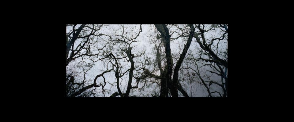
The topography of the Quarter is rugged. Here, in the Shasta-Trinity, Klamath, Six Rivers, Modoc, Lassen, and Plumas National Forests, deep river gorges drain an almost vertical landscape cloaked with oak, madrone, pine, redwood, and fir.
The Quarter’s economy has always been natural resource-based. In the western portion, the Yurok, Hupa, Karok, and Klamath tribes that settled along the Klamath River and its tributaries prospered from the abundant fish and game. They built houses of redwood and incense cedar planks, and conducted a brisk trade in dentalium shells, a de facto currency among western tribes. The main economic difference after the arrival of Euro-Americans was the scale of resource extraction. Timber, minerals, and fish were exploited on an industrial—and ultimately, unsustainable—scale. The gold has played out, the big timber has been mostly cut, and the salmon runs have dwindled due to dams and overfishing.
In many of the towns of the western Quarter, the timber industry’s decline has left the impression of a neutron bomb attack. A sad and decrepit air pervades these formerly prosperous logging communities. Structures remain, but many are empty and in a state of decay. Mills have been shuttered, as jobs—and even the mills themselves—shift overseas. Marijuana cultivation and methamphetamine production have replaced conifer harvesting and processing as economic mainstays. Still, the forests are verdant with resurgent second- and third-growth trees, and the mountains and rivers abide.
The land takes on a radically different aspect east of the Sacramento Valley—although, like the western part of the Quarter, it is most notable for its emptiness. It feels distinctly “un-Californian”—not surprising, considering it lies at the margins of the Great Basin. This is a place of sage flats and barren volcanic necks and ridges of blackened basalt. For miles around Lassen Peak, the land is littered with volcanic bombs, great boulders of pitted dark rock expelled during past eruptions. Extensive forests lie at the higher elevations, particularly near Lassen Peak and Mount Shasta, but their composition is generally simpler than those west of the valley, with Jeffrey pine predominating. Logging was once an economic driver here, but as in the west, the mills are now derelict, reduced to cracked concrete pads, twisted girders, and piles of rusting sheet metal.
Ranching remains a functional, if shoestring, enterprise. Cattle are scattered among the sage flats, more abundantly along creek bottoms where there are sedges to graze. These arid lands once teemed with vast herds of sheep, tended by itinerant Basque shepherds. The ovines and their overseers are gone now, leaving behind only a few Pyrenean surnames among the local populace and an occasional Basque “family style” restaurant.
As in the west, settlements are both few and small in the eastern Quarter. Susanville and Alturas are the largest, with respective populations of 17,700 and 2,800. In Susanville, most of the town’s residents are supported, directly or indirectly, by the High Desert State Prison, a maximum-security lockup.
I’ve lived in the Empty Quarter, and I continue to explore it, by car and by foot, whenever opportunity permits. I enjoy it not just for its profound natural beauty, but because it remains indifferent, even hostile, to the visitor; I know I can always find solitude here.
A friend and I took a trip through the Quarter not long ago, and as usual, it lived up to my expectations—in part because I keep my expectations low in terms of amenities, but largely because of the unchanging, magisterial qualities of the landscape.
Our tour had started as a quail hunt in The Nature Conservancy’s Dye Creek Preserve east of Red Bluff. We spent a morning and afternoon stumbling around the volcanic rock-studded oak savannahs of this vast, upland property, bagging only a couple of birds for our exertions. But the wildlife was abundant and provided the day’s true satisfaction. Colonies of Lewis’s woodpeckers—large, colorfully plumaged birds not often seen in my home county of Sonoma—flitted and yammered around the oaks. We jumped flocks of wood ducks off some stock ponds, admiring them as they dodged through groves of cottonwoods and willows.
The Dye Creek Preserve constitutes a critical corridor for California’s largest herd of migratory deer, and they were moving during our visit, funneling down from the northern Sierra to their winter range in the low foothills bordering the Sacramento Valley. We saw more than 50 deer, including several bucks with heavy, symmetrical racks. Raptors were also in migratory mode. Hawks, large and small, perched on every dead snag and fence post.
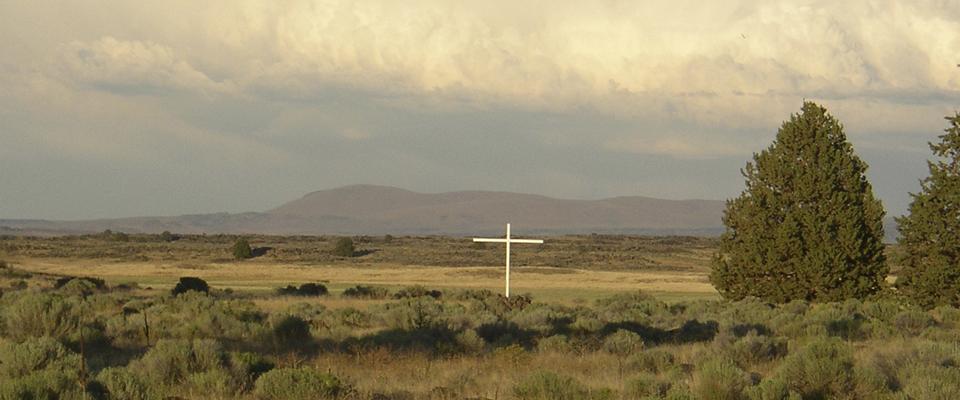
We left Dye Creek the following day and drove east on Highway 36. A quick-moving late-fall storm had preceded us. Thin, wet snow covered the land, and a wind cut through the Jeffrey pines. We exited the forests after a couple of hours and drove into basin-and-range country. A group of pronghorn huddled in the lee of a small sagebrush-covered hill. I felt we were in the perfect setting for one of Annie Proulx’s Wyoming stories: the frigid land, the antelope, an empty highway, a faraway, low-slung huddle of ranch buildings.
We drove through Susanville, finding nothing to detain us; the streets were cold and mottled with slush, and empty. Was everyone at the prison, either incarcerated or pulling a shift? Outside of town, we turned north on Highway 395 and drove 90 soporific miles under lowering skies and occasional snow flurries to Alturas. Off to the east lay the Warner Mountains, an 80-mile-long cordillera that is part of neither the Cascades nor the Sierra, but one of the westernmost Great Basin ranges. The Warners are lovely and isolate mountains and we had hoped to visit them, but the foul weather convinced us to settle for a Mexican lunch in downtown Alturas. We were the only customers in the restaurant. Outside, a yellow dog with a spavined gait wandered down the middle of the street.
The clouds began to break as we drove west from Alturas, adding shafts of brassy light to the landscape. This is a region of blue-ribbon trout streams. Hat Creek flows here, and the Pit, McCloud, Fall, and Upper Sacramento Rivers, all considered hallowed sanctums in fly fishing circles. I had fished some of these waters and caught a few trout for my efforts. But the one that stands foremost in my memory was an 18-inch rainbow I hooked while drifting nymphs on the Pit. As soon as the fish struck, I slipped on the mossy, boulder-lined bank. Three things then happened in staccato succession: I fell on my ass, the fish leaped, and my tippet snapped. I can still see that trout soaring above my head.
That night we stayed in Yreka, another town in genteel decay. The next morning, we thought of taking Highway 96 along the Klamath River through the Hupa, Yurok, and Karuk nations. These tribes have lived along the Klamath for 7,000 to 10,000 years, arguably making them the oldest continuous cultures in North America. We took Highway 3, though, west through the bucolic Scott Valley, and then turned south over the Scott Mountains to the western shore of Trinity Lake.
We passed through Weaverville, where we had excellent coffee and lox and bagels served up by the ultra-hip comic book enthusiasts managing a small coffeehouse on the main drag. Fortified, we followed Highway 3 another 30 miles over serpentine asphalt to Hayfork, another cashiered mill town, and my home for several years in the late 1970s and ’80s when I worked for the U.S. Forest Service. I was depressed to see that the home I had built with my ex-wife had burned to the foundation, and the property turned into a compound of trailers, shacks, and dismembered Harleys. I resisted the urge to stop and reminisce with the current residents, and we drove on, connecting to Highway 36 outside of town.
In a region of dicey mountain roads, Highway 36 from Hayfork to the Humboldt County coast stands out as an exemplar of the category, wending its way through the precipitous canyons of the South Fork Trinity, Mad, and Van Duzen Rivers. You repeatedly gain and lose a lot of elevation on this highway, but the views are seldom expansive. Heavy forest covers the mountains, with hardwood canopies sometimes converging right over the roadway. My travel companion, a carnivore biologist who had never visited this part of the state, was enthralled, and was especially taken by the vast stands of mature black oaks. They’d produce enough acorns, he averred, to support healthy populations of grizzly bears.
“California was thick with grizzlies 150 years ago,” he said. “You look at this country, you see why. It looks basically the same now as it did then—no people, and full of food.”
At Bridgeville—a tiny, privately owned hamlet on the Van Duzen that has enjoyed some modest fame for having been listed for sale three times since 2002, two of them on eBay—we turned south on Alderpoint Road, which terminated 50 sinuous miles later in Garberville on Highway 101. Wildlife remains abundant here: deer everywhere; quail foraging through the understory; with pileated woodpeckers, varied thrushes, hard-to-identify warblers, and red-shouldered and Cooper’s hawks ghosting through the trees. At one point, a blue grouse—a large, somewhat dim-witted bird with slate-colored plumage—craned its neck and goggled at us as we drove by.
About 20 miles northeast of Garberville, the vistas opened up. The land was as heavily wooded as ever, but in front of us, the slopes fell away in terraces into what seemed a hanging valley, punctuated in its center by small hills. The air was green and gold and misty. We seemed infinitely remote from any inhabited place, but it didn’t feel like we were in a wilderness. This landscape was too exquisite; it somehow seemed cultivated—constructed, even.
I stopped the truck in the middle of the road. We knew no one would come—we’d seen only one other car since Bridgeville. We didn’t say anything. Eventually we’d have to leave and drive into Garberville and take Highway 101 south, to the other Californias. But for now, we didn’t want to think about them. We didn’t want to acknowledge them, let alone return to them.
Glen Martin is an avid outdoorsman and journalist.