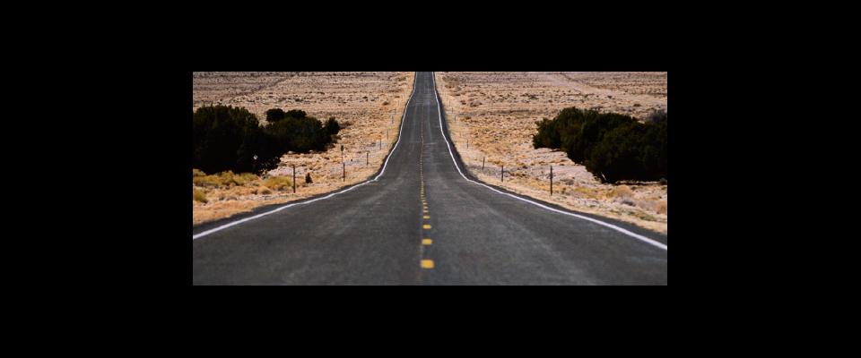
Highway 50 through Nevada provides more than breathing room.
Only the most torpid and soul-deadened of us have not heard its siren call: The Road. And we respond. That’s why On the Road is still in print. That’s why Harleys still sell. That’s why road-trip movies, no matter how inane, remain popular. We may be burdened by work (or the lack thereof), family obligations, and debt. But the urge to throw off the traces, to hit the asphalt with no plan but to sprint for the horizon, remains evergreen.
And yet, The Road itself—that Platonic Ideal of an empty American highway leading off to a hazy void called Freedom—has diminished. That’s because there aren’t many roads like that anymore. They’ve filled up. When Kerouac wrote On the Road, the U.S. population was about 155 million, and there was no national freeway system—just a tangle of blue highways that intersected in a tantalizing fashion, promising idiosyncratic regional food and adventure at every milepost. Today, we number more than 300 million. You can get on an interstate in New York and end up in San Francisco three days later and recall nothing of the trip except the dyspepsia from too many Quarter Pounders. And the freeways will be packed; so will the arterials. You’ll feel like a lemming rather than an eagle.
But there are still a few Kerouac-esque roads in this country that promise … well, nothing and everything: a dead end, a Viking funeral, or a new start. Most are in the West, of course. And the best is Highway 50 through Nevada.
Running from Sacramento to Ocean City, Maryland, Highway 50 is one of the older interstates, officially dubbed U.S. Route 50 in 1926 and largely supplanted by I-80 in the 1960s. These days, of course, its relatively light traffic is its primary charm. The Nevada Commission on Tourism touts it as The Loneliest Road in America. If the idea was to attract hordes of visitors, it has failed magnificently. The rubric is, however, an accurate description of the road as it is and undoubtedly will remain.
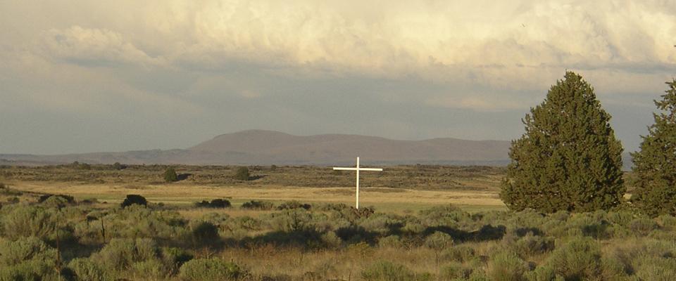
Route 50 through Nevada isn’t just about solitude; other roads—through the Rockies, the Sierra, Alaska, the Great Plains—embody solitude well enough. Route 50, however, is a truly lonely road. It has a unique specific gravity, poised between emptiness, failed human enterprise, and the kind of blind hope that keeps you from slitting your wrists despite all the evidence that it may be the best option. These intersections of melancholy can be found all along the road. A broken-down barbed wire fence transects a sage-covered basin big enough to swallow Manhattan. A fat, preening raven perches on the rib cage of a dead cow. A sign on a telephone pole decries the region’s methamphetamine plague.
On one level, this is deeply depressing. But there is also a skewed pleasure derived from the obvious failures that have left their mark all along the highway. This is partly due to the schadenfreude latent in all of us: Your cow died, your ore vein played out, you have a drug addiction—but I’m OK, Jack, tooling down this well-surveyed and impeccably surfaced road, sipping a cold Pepsi One, my radio tuned to New Country or brimstone-and-damnation evangelical oratory.
But implicit in the manifold signs of defeat along the road is the message that failure is as much an unalienable American right as the pursuit of happiness. Not everybody who followed this road made it—that’s all too obvious. But at least they gave it a shot. Maybe you’re in the same boat. If so, a trip down Route 50 will be anodyne. It will tell you that success is evanescent. That human endeavor of any sort amounts to little more than hen-scratchings, while Earth abides. The great alkali playas, the black scree, the basalt palisades are all witness to our puniness and folly. They exist in deep geologic time, while we twitch and yearn, breed hotly, and die like mayflies, leaving our ephemeral husks behind.
Which isn’t to say you can’t do a little sightseeing on your way to the void.
Heading east from the California border, the “lonely” part of Route 50 starts just outside Fallon, a somewhat threadbare Nevada town most notable for the adjacent Navy airbase and flight school. Day and night, the nation’s best fighter pilots rip around Fallon’s aerial environs, presenting thrilling displays of tactical flying the jaded locals hardly notice. East of town is the Grimes Point Petroglyph site, which provides one of the time-bending experiences emblematic of Route 50. You stroll among boulders etched with 8,000-year-old images of big game, gods, and demiurges while jets skirmish across the highway.
This is the western margin of the Great Basin, the floor of an ancient sea broken into a wavelike topography: high and low, basin and range. Down low it’s all black rock and white alkali, sagebrush and spindly cheat grass, but climb the ridges and things become surprisingly lush: mature pine and juniper forests with flycatchers, bluebirds, and buntings squabbling in the branches, meadows thick with bunch grasses, an occasional spring overgrown with monkey flower and skunk cabbage.
About midway across the state is the minute town of Austin. It teetered for years on complete abandonment, but now appears to have a small, stable population of hard-core desert rats. Strung along Highway 50 as it climbs the west slope of the Toiyabe Range, Austin was founded in 1862, one of the many now-declining or utterly derelict towns that were part of Nevada’s great Silver Rush. Supposedly, the rich lode was discovered when a Pony Express rider’s horse kicked over a rock heavy with silver. This is credible, in that Highway 50 parallels the original Pony Express route. In any event, mining is still pursued on the sere slopes surrounding Austin—but for turquoise, not silver. Some of the richest turquoise deposits in the Southwest are found here.
A few years ago, turquoise was retailed rather casually in Austin—you could pick up rings and pendants, fabricated by local jewelers, for a relative pittance. More progressive marketing schemes prevail today, however, and the four or five jewelry shops along Austin’s steep and short main drag price their turquoise for upscale consumers. Still, ambition hardly seems destined to “spoil” Austin. No one’s getting rich here, as the abundance of shuttered storefronts attest.
Wildlife abounds in the country surrounding Route 50, though motorists typically see little of it. The Great Basin is hot and dry, and many species are nocturnal or crepuscular. And virtually all of them are extremely shy or have developed qualities of camouflage to avoid detection. Mule deer are often seen at higher elevations, as are elk. Wild horses are fairly abundant across all habitats except the playas. Irrigated alfalfa pastures are good places to spot pronghorn antelope. Rocky Mountain bighorn sheep inhabit some of the ranges transecting Highway 50 but seldom venture close to the road.
Cougar and bobcat are both relatively common in vegetated areas, but are not easy to spot. One predator seen with some regularity, however, is the coyote. They are ubiquitous, and sometimes strangely oblivious to human beings.
Birders should seek any place with trees or water—ideally, both. Route 50 is especially good for observing raptors: ferruginous or rough-legged hawks perched on telephone poles are obvious in this spare landscape. That said, binoculars are a must: A duotone of gray and beige may resolve into a badger or jackrabbit crouched under a clump of sage; the scattering of white motes on a distant alfalfa field becomes a herd of pronghorns.
About 150 miles from Austin is Ely, the last town of any size before the Utah border. Size, of course, is relative—only 4,000 people live here. Like most burgs in Central Nevada, Ely was founded on mining; the Robinson Mine, one of the world’s biggest open-pit mines, sits just outside of town and still yields copper and molybdenum. But Ely is facing a dilemma: whether to die of thirst or from economic strangulation. Quadra Mining, which owns the mine, needs to expand the pit to keep operations profitable. This will involve destruction of the springs that supply Ely with water. The springs already have been adversely affected by mining activities, and no easy solution seems likely.
Still, there’s water in the pipes for now, and Ely is a logical place to stop for the night. Route 50 runs right through the middle of town. There’s the usual huddle of motels, but a good alternative is Hotel Nevada—a building of historic significance, boasting the amenities of a small casino: 24-hour restaurant, a decent bar, and stuffed animal heads on the walls. The hotel is clean and prices more than reasonable, although socializing can get a little manic when the miners and visiting bikers get together to knock back some brews.
Utah is only 40 miles from Ely. A few miles before the border, there’s a turnoff for Great Basin National Park. Take it. By most accounts, this is the least visited national park in the Lower 48, which in itself is a significant incentive for investigation. But along with elbow room, you’ll find Lehman Caves, a lovely marble cavern festooned with stalactites and stalagmites; groves of 4,900-year-old bristlecone pines; and some pretty good trout fishing. Great Basin National Park has a richly varied topography, from 13,000-foot Mt. Wheeler to basins situated 6,000 feet lower. This creates an abundance of ecological niches; the park has 73 species of mammals, 238 species of birds, 8 fish species, and more than 800 species of plants.
Its many diurnal attractions notwithstanding, the park is best appreciated after dark. The night sky here is far removed from any source of artificial light. Forget the tent. Sleep in the open. Snug in your bag, flat on your back, the stars in their millions hang down in your face. They and the occasional meteorite are your only companions. Your loneliness is absolute: alienating, a little frightening, and completely delicious. You can only feel grateful for the road that has brought you here.


