


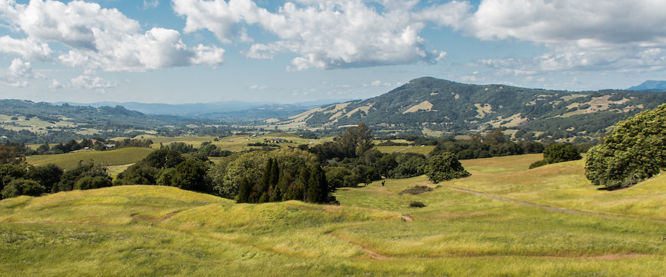
When the Tubbs and Nuns wildfires exploded across Sonoma County in 2017, firefighters found they lacked critical information. Details on the vegetation, structures, and roads distributed across the landscape would have helped them better evacuate residents and allocate fire suppression resources.
It was only after the fires were extinguished that authorities realized much of that data was available—in the form of “veg maps.” Created by the Sonoma County Agricultural Preservation and Open Space District, Ag + Open Space as it’s known locally, the maps deconstruct the terrain, depicting slope, aspect, soil type, hydrological qualities, buildings, roads and driveways—even the density of trees and brush—in exquisite detail.

Such maps, officials realized, could be an immense asset when responding to wildfires. They could even serve a preventative purpose: helping “fireproof” undeveloped land by turning open space from a wildfire liability to a fire-prevention asset.
The maps are produced through LiDAR, or Light Detection and Ranging, which is kind of like radar, except it uses pulsed lasers emitted from aircraft or satellites instead of radio waves. The process yields precise 3-D maps of the earth’s surface, detailing vegetation type and density. Researchers can look at a LiDAR map and evaluate “fuel ladders”—deadwood on the forest floor combined with the limbs and branches running from the ground to the tree tops—in any given stand of trees, down to resolutions of one centimeter.
“Using the maps for wildfire response wasn’t our original intent,” says Karen Gaffney, a UC Berkeley alumna and the conservation planning manager for Ag + Open Space. Originally part of a project supported by the Sonoma County Water Agency and grants from NASA, the maps were created for land and wildlife conservation purposes. “But it just so happens much of that data is proving valuable for disaster planning.”
The maps are being used to flag the best fire evacuation routes and the sites most susceptible to contamination or erosion post-fire.
When it comes to wildfire, it’s largely about fuel. While the forests of the West were once subject to regular low-intensity fires that produced large, well-spaced trees and light accumulations of deadwood, more than a century of overzealous wildfire suppression and rising temperatures from climate change have reversed this dynamic. Combine the current dense, thicket-like stands of trees and piles of dead branches with hot, dry autumn winds, and the result is wildfires of devastating ferocity—wildfires like the 2017 North Bay fires and the 2018 Camp Fire in the town of Paradise.
Like many areas, Sonoma County has been attempting to use “prescribed” fire and tree thinning to reduce fuel loads, says Gaffney. Shortly before the Nuns Fire ripped through Glen Ellen, an experimental prescribed burn conducted at a nearby ranch demonstrated the effectiveness of such efforts. The encroaching wildfire immolated nearby woodlands and structures, but dropped to low, flickering flames when it hit the prescribed burn zone. There simply wasn’t the fuel to sustain it.
The message was clear to the county’s disaster response planners: the more wildlands that can be burned under controlled conditions, the better.
The district’s veg maps are now being used by county officials to identify candidate open spaces for thinning and prescribed fire, with prioritization going to the most vulnerable areas.
“In conjunction with our partners at Pepperwood Preserve and Tukman Geospatial, we’ve created fuel loading maps from our LiDAR data that identify areas where heavy ladder fuels are located close to structures,” says Gaffney, who declined to comment on specific sites. “And because we can map development footprints down to resolutions of one centimeter, we can even identify risks for individual buildings.”

The maps are also being used to flag the best fire evacuation routes and the sites most susceptible to contamination or erosion post-fire.
“For example, we can determine if a [burned] structure that contained toxic materials is at significant risk of contaminating a nearby stream,” Gaffney says. “While the maps first responders and firefighters typically use show all the major and secondary roads, our data let us create maps that show the much smaller routes that could also be used for evacuation.”
The veg map approach to wildfire response and planning is gaining fans beyond the borders of Sonoma County.
“Marin County and San Mateo County have acquired LiDAR technology and are creating their own veg maps,” says Allison Schichtel, the conservation GIS coordinator for Ag + Open Space, “and Monterey and Santa Cruz Counties are looking into it. I did a presentation at a forestry and GIS workshop, and there were folks from [far] northern California and southern Oregon who wanted to know all about it. Interest is growing—kind of like an amoeba.”