The light is fading on a bitter-cold December afternoon in Berkeley, and Trevor Paglen is talking about spy satellites. Specifically, he’s explaining how hard it is to photograph them—not just because our government doesn’t want us to know they’re there but also because they’re a long way away. “You’re basically trying to shoot something the size of a car on the other side of the Earth, but actually it’s even farther,” he says, his words dissolving into a machine-gun laugh. Then, dissatisfied with the imprecision of his statement, he says, “Wait, you know what the diameter of the Earth is?” He’s silent for a minute as he pulls out his iPhone and searches the Web, and then: “Yeah, it’s 8,000 miles, so that would be …” He trails off again, running the calculations in his head. “Yeah, shooting something a little bigger than a car but from a distance of three times further than China.” Another rapid-fire laugh. “It’s far away.”
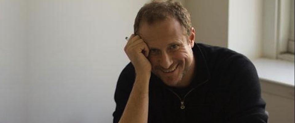
Paglen is a 35-year-old artist, geographer, writer, and photographer who holds both a B.A. (religious studies, 1998) and a Ph.D. (geography, 2008) from Cal, as well as an MFA from the School of the Art Institute of Chicago. He’s now a researcher at Berkeley, a position he juggles with a wide range of side projects—everything from speaking gigs on digital imaging to essays on “vertical geographies,” or the ways in which man, via spacecraft, has extended the boundaries of the Earth.
Most often, though, his work traces the seam line between the government’s desire for secrecy and the public’s right to know. Besides the spy satellites, which he captures arcing across the night sky in lush art prints, Paglen has photographed classified air bases; tracked down CIA cover names and displayed them on gallery walls; and compiled a book full of patches from Pentagon black-ops units. It’s called I Could Tell You but Then You Would Have to Be Destroyed by Me. The patches—in some cases, the only evidence that the programs even exist—feature an absurd gallery of aliens, reapers, and wizards along with perverse accompanying mottos. One from the stealth bomber wing reads Gustatus Similis Pullus, Latin for “tastes like chicken.”
When Paglen was a guest on the Colbert Report, host Stephen Colbert feigned outrage over the supposed intelligence breach. “Now our enemies know about our secret army of topless women riding killer whales shooting lightning from their hands! What kind of American would reveal that information?”
I first met Paglen on the fifth-floor balcony of McCone Hall, the geography department’s home on the north side of campus, where we sat on a ratty couch with a panoramic view of the bay. Given the nature of his work, I had expected a fire-breather. Instead, he was soft-spoken, a little reticent. He considered my questions carefully, unspooling his answers slowly and occasionally reeling them back in for revision. He often speaks in conceptual terms, and some of his pronouncements sound cryptic, which seems fitting for a man who has blurred the distinctions between geography and art and counterintelligence. He says that while we know the outlines of what our government is up to, “there’s so much more. There’s tons and tons of fragments. How do you represent the fact that the information runs out but there’s something more there?”
A few years back, Paglen spent a week holed up in a room on the 18th floor of the Tropicana, in Las Vegas. He wasn’t there to gamble, but to photograph. The room had a commanding view of an unmarked section of the city airport that is off-limits to the public. With the help of a telescope, a camera, and a military-band radio scanner, he passed his days watching a fleet of nondescript airplanes come and go. He shot them picking up and disgorging passengers, monitored their communications with air traffic controllers, and carefully noted tail numbers, which he then crosschecked against FAA records.
What he emerged with was a remarkably detailed picture of the shuttle service that ferries civilian workers to and from innumerable covert U.S. military bases scattered across the desert. It’s a big operation: An estimated 4 million American workers have security clearances of some sort, and a good number of them are based in the Southwest, in what the economist Ann R. Markusen dubbed the “gunbelt.” Paglen charted these flights to and from the Nevada Test Site, a restricted area the size of Switzerland, and Groom Lake—within the notorious Area 51, where the Air Force secretly tested, among other things, the stealth bomber.
Some of these photos—impressionistic images of jets shimmering on the tarmac in the desert heat—wound up in art galleries. One, titled Morning Commute, shows worker bees with short-sleeved shirts and messenger bags climbing the boarding steps to a red-striped Boeing 737. The composition has a banal beauty that, in context, turns sinister. And like most of Paglen’s work, it’s difficult to categorize—or indeed to recognize as geography. But in Blank Spots on the Map, his 2009 book on the ways in which official secrecy warps our democracy, Paglen makes the connection, writing that the flights “showed how disparate places throughout the Southwest are connected to one another, each plane forming one part in a larger geography of military secrecy. They were a kind of map.”
That may sound tenuous to those outside the field, but Paglen’s colleague Michael Watts, a geographer who has spent years examining the oil-fueled conflict in the Niger Delta, says, “Trevor is a geographer’s geographer. It’s a very different sort of fieldwork than many of us were thinking about 30 or 40 years ago, but it’s very much rooted in that muddy-boots-oriented approach to the discipline. He’s out there trudging through the Southwest with these massive camera lenses—my God, could there be anything more geographical? But it’s geography for the 21st century.”
Lisa Parks, chair of UC Santa Barbara’s Department of Film & Media Studies has accompanied Paglen on some of his photographic forays in the desert. She echoes Watts’s assessment: “As a geographer you can provide a map that seems to give the viewer answers, or you can do what Trevor does. His mapping is all about clues and hints and partially exposed views.”
The son of an Air Force doctor who treated spy-plane pilots, Paglen spent his youth bouncing from one air base to another. He tells a story from his years living in Germany, in which his brother accompanied a friend to drive the friend’s father—a spook of some sort—to work. “They drove him to this cornfield, and he walked into the corn,” Paglen says. “Shit like that would happen all the time, but it didn’t register as being weird.” Looking back, he guesses that these were formative experiences.
He ended up at Berkeley, drawn not so much by the scholarship as by the East Bay punk scene and its anti-authoritarian, DIY ethos. Paglen spent much of the 1990s playing bass and sampler in an avant-garde band called Noisegate, which combined field recordings, ambient keyboard washes, and meticulously calibrated pummelings of noise. After a few albums, however, he grew frustrated with music’s limits—its language of compositions and time signatures just couldn’t communicate what he wanted to say. Increasingly, he wanted to explore the cultural space in which music existed and prospered. “How do you explain the fact that we go see these pieces in concert?” he asks. “There are all of these social relations, and economic relations, and we have these pictures of musicians everywhere.”
Eventually he turned to visual art, and got his MFA in Chicago, where he was deeply influenced by the situationists, a 1960s-era movement that rejected any separation between art and politics. The situationists were obsessed with the spaces we inhabit, both physical and cultural, and bent on transforming them. To drive home their anti-capitalist, anti-consumerist message they staged performance art pieces that were actually large-scale pranks—for instance, they once published a pamphlet purporting to show that Italy’s moneyed elite supported a 1972 terrorist attack. “They weren’t about making art that reflects life,” Paglen says. “They were about changing the everyday conditions of life.” The situationists appealed to his punk sensibilities, but as freeing as art was, he felt that it lacked rigor. Situationist-style pranks were easily trivialized and co-opted. What Paglen wanted was a systematic way to map his explorations of the physical and cultural spaces we inhabit. Then it hit him: geography.
For millennia, geographers mostly devoted themselves to mapping unknown territories in the name of God, king, or country. To map was to control, and cartographers were as crucial to any expeditionary party as soldiers were. The profession suffered a crisis in the early 20th century, however, after the physical earth had been mapped from pole to pole. Bereft of an animating principle, the field drifted for a few decades and a number of elite universities (Harvard, for one) shut down their programs entirely.
American geographers, forced to rethink their role in the world, generally divided into two camps: One contingent embraced new computer-driven mapping technologies and threw itself into crunching and modeling data from satellites, remote sensors, and the like; another took a more conceptual route, throwing itself into the pursuit of big ideas. While not eschewing technology, the Berkeley School, as it has come to be known, tends to be more humanistic and less dispassionate. “We are largely committed to the study of human behavior,” said Carl Sauer, the geographer who led the department from 1923 to 1954. “It is proper and reasonable that we are troubled as to how man has acted for good or evil.”
Today, geography is a famously wide-open field, embracing everything from apolitical catalogs of California plant life to leftist critiques of Baltimore’s social order—anything that inhabits or happens on earth is fair game. Paglen has stretched those boundaries even further, combining academic theory with visual savvy and an attention-grabbing pop-culture sensibility. He is at the forefront of a new movement called “experimental geography,” a term he coined himself in 2002. Rooted in both fine arts and political activism, experimental geography is more expansive in form than its mother discipline, embracing not just academic theses but whatever medium seems best suited to the message. The work is astonishingly varied, taking in online multimedia explorations of the ways in which Pasadena has changed, an audio-guided walking tour of the hidden lives of guest workers in the United Arab Emirates, and a guy on YouTube drilling holes through an atlas, each puncture representing a different place he’s lived. As Paglen puts it, “Why should we limit ourselves to peer-reviewed journals? It greatly limits the audience and, I think, greatly limits what we can say.”
In the process, Paglen has helped turn a discipline once most closely associated with the rote memorization of state capitals into something new and hip. Indeed, Paglen himself has practically become a brand: At the same time that his work sells in bookstores and hangs from gallery walls, it also appears on clothing. Last year, New York streetwear company Freshjive put out T-shirts and caps emblazoned with some of Paglen’s black-ops patches, including one showing a question mark, a crescent moon, and the menacing acronym NOYFB.
Gray Brechin, Berkeley geographer and author of Imperial San Francisco, says simply: “He’s our superstar.”
The night after our meeting in Berkeley, I visited Paglen’s live/work studio in the ghostlands of West Oakland. He had spent most of the last year in New York, and many of his belongings—the majority of which appear to be books, from Marx to Derrida to Philip K. Dick—were still in boxes. Two surfboards leaned against a rough concrete wall, a collection of camera tripods and telescopes sat near a small oriental rug by the windows. We sat on folding chairs at a small table.
“I’ve only ever had a living room in this house,” he explained, opening a beer, “and I don’t know what to do with it because I just work. I got this table because I’ve never had a place to eat food, so I thought I should be an adult and have a place to sit.”
An archipelago of desks and computer monitors occupied part of one wall, the big middle screen displayed a stark photo he recently made in Death Valley. At the center of the frame is a jagged peak, surrounded by crisp points of starlight. My eyes were drawn to the peak first, then I noticed the streak of light above it: It’s a “dead” satellite, Paglen explained—one its owners can no longer control but that soldiers on regardless. The image is part of a series he’s working on, showing satellites in iconic western landscapes first made famous by Gilded Age photographers like Eadweard Muybridge and Timothy O’Sullivan.
In the late 1860s, the government commissioned O’Sullivan to shoot the Southwest, most of it recently taken from Mexico, to attract Anglo settlers to the region. One of his most famous images is of Pyramid Lake, Nevada, a spooky photo in which rocks jut from the water like ziggurats. Paglen made a similar image last year, a dusky shot with the same pyramid-like rock in the foreground. At the top-right of the frame, however, is a blur of bright light: DMSP 5B/F4, a satellite that monitors weather for the Pentagon. Paglen notes that photography, like cartography, has also been a tool of empire. “A lot of those guys [photographers like Muybridge and O’Sullivan] were to the 19th century what spy satellites are to the 20th and 21st century,” he says.
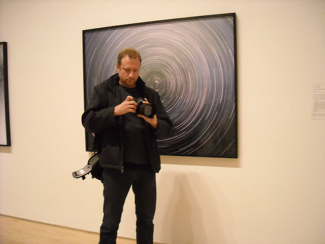
To shoot spy satellites, Paglen first has to plot their coordinates using raw data from a network of amateurs. He then uses that information to pinpoint where on the horizon the satellite will be, and in what relation to the landscape he intends to shoot. Then he scouts the locations, lugging a backpack full of heavy camera gear into the backcountry. Satellites are best shot at dusk, he explains, when there’s still some light in the sky, but for other projects he’ll shoot all night. Aesthetically, the results are sublime. But more than that, Paglen is turning a photographic tradition inside out, a neat conceptual backflip that comments both on the original work and on the hidden ideologies that motivated it.
At the Altman-Siegel gallery in downtown San Francisco, I studied a 40×60 print of one of Paglen’s shots of the chemical and biological weapons proving ground in Dugway, Utah. Paglen took the photo near midday with a 7,000 mm lens, from 42 miles away. The combination of distance and heat rendered the composition almost completely abstract—a wash of sand, salt, and sky. There are a few spy satellite images in the gallery, too. One is a shot of space, of the Draco constellation in the far Northern Hemisphere, blue-black and spotted with countless pinprick stars. A naval surveillance satellite cuts through the frame. It looks like a shooting star, like it belongs there.
It reminded me of something Paglen said about believing in truth but at the same time being suspicious of it. “I can go out and calculate the orbit of a spy satellite and it will show up exactly where I tell you, down to the second,” he said. “So that’s a certain kind of truth.” On the other hand, he said, “In a lot of my photographs there’s a streak, and I’ll say the streak is of a spy satellite moving through the sky. How do I know what it is? Why the hell should you trust me?” And then he exploded in laughter.
Learn more about Trevor Paglen


